

The Kawartha Trans Canada Trail is multi-use from Lindsay to Fowlers Corners. The trail has been surfaced (hard-packed limestone) is flat and level and passes by scenic rivers, wetlands and vary of landscapes. There are many access points including County Road 36, Omemee and road crossings between Lindsay and Peterborough.
Trails

There are more than 600 km of trails spread across Kawartha Lakes. The Ganaraska Trail, Kawartha Trans Canada Trail and Victoria Rail Trail Corridor have several access points in different areas of Kawartha Lakes.
Whether you're hiking, cycling, ATVing, horseback riding, snowmobiling or cross-country skiing - there's a Kawartha Lakes trail waiting for you.
Regional and provincial parks offer nature trails through conservation areas that are great for birding and wildlife viewing.
Cross-Kawartha Trails
The Ganaraska Trail is a recreational trail with a total length of 500 km. Since 1967 it has been developed and maintained solely by volunteers and private landowners. The trail stretches across every type of landscape possible. Its route crosses parts of the Somerville Tract and the Victoria Rail Trail.
The Kawartha section starts on the Victoria Rail Trail where it intersects with Crosswinds Road, south of Reaboro. It follows the rail trail to Lindsay, along the Scugog River for some distance, and then takes the Victoria County Recreation Corridor, which it follows to 2 km past Burnt River. At this point, the trail increasingly sees evidence of Canadian Shield country. The section ends in Moore Falls after 77 km or varied terrain.
The first 50 km are flat, and the next 20 km are rugged. The last 5 km are on country paths from Buller Road to Moore Falls. This section is suitable for novices.
The Kawartha Trans Canada Trail offers a natural recreational corridor for people of all ages and abilities.
This historic railway bed is now a magnificent recreational corridor with a crushed limestone surface. This 53.8 km section of the national trail traverses east to west across Kawartha Lakes. The trail surface is 3 metre wide, hard-packed limestone which provides flat level surface, ideal for a variety of trail uses.
You will encounter woodlands, farmlands, wetlands, and communities. For the most part, the trail is relatively flat, with modest changes in elevation throughout its entire length. Trail users will find facilities such as benches, bicycle racks, and picnic shelters along the way.
Core Trail Uses: Hiking/Walking/Running, Cycling, Horseback Riding, Cross-Country Skiing/Snowshoeing, Snowmobiling
Prohibited Uses: With the exception of snowmobiles, all motorized vehicles including ATV's and dirt bikes are not permitted on the trail.
Discover the Doube's Bridge History
The Kawartha Trans Canada Trail goes through Lindsay on hard-packed limestone. It is flat and level allowing for easy travel passing the villages of Little Britain, Oakwood and Manilla on the way to the Town of Uxbridge and beyond. There are access points at Sir Sandford Fleming College Frost Campus or Angeline Street South behind Sweetnam Drive in Lindsay. There are numerous access points where the trail crosses roads heading west.

The Victoria Rail Trail is an 85-kilometer rail trail in Kawartha Lakes with corridors linking Kinmount to Bethany, through Fenelon Falls and Lindsay. This public, multi-use trail is uniquely linked by affiliated trail connections for the explorer in all of us. The VRT is open year round for the avid outdoor enthusiast, honouring the rules and regulations for seasonal usage. Always take the scenic route.
The online interactive trail map will assist in your planning and exploration of the Victoria Rail Trail and its affiliated trail connections.
For an accessible format of the Victoria Rail Trail map contact tourism@kawarthalakes.ca or 1-866-397-6673.
The North Corridor follows the former CN rail line north, from Fenelon Falls to Kinmount. Stop for a picnic lunch at Island Park or view the falls at Trent-Severn Waterway Lock 34. The trail follows Cameron Lake and then the Burnt River leading into Somerville Tract which is heavily forested and perfect for hiking, bird watching and wildlife viewing. After leaving the Forest, head north past the Crego Creek Bridge and into Kinmount.
Recommended Access Points:
- Fenelon Falls at Garnet Graham Park
- Fell Station West of Arterial Road 121
- Burnt River North of the former Burnt River Library
- Watson's Siding West of Arterial Road 121, South of Monck Rd.
- Kinmount at Austin Sawmill Heritage Park, Pinery Road
The VRT Central Corridor begins in the north end of Lindsay at Thunderbridge Road and takes you north to Fenelon Falls. ATVs and Snowmobiles are permitted from Thunderbridge Road north honouring the rules and regulations for seasonal usage and permitted uses.
Recommended Access Points:
- Fenelon Falls (South) (limited parking): Old Railway Station
- Cameron (limited parking): Long Beach Road (Kawartha Lakes Road 34), East of Highway 35
- Kenrei (parking available): Kenrei Road at Victoria Rail Trail
- Lindsay (limited parking) (motorized north, ATVs and Snowmobiles): Thunderbridge Road
- Lindsay (limited parking) (non-motorized): Victoria Avenue North, between Pottinger Street and Susan Court.
Always take the scenic route. Interact with us by using our Victoria Rail Trail Interactive Map. Explore affiliated trail connections that connect you to the VRT North and South corridors.
The VRT South Corridor is part of the old CP Rail Line and extends 30 kilometres from Lindsay to Bethany. ATVs and Snowmobiles are permitted from Logie Street South honouring the rules and regulations for seasonal usage and permitted uses.
Recommended Access Points:
- Lindsay (parking and washrooms available): Kent Street East at Old Mill Park
- Lindsay (limited parking) (motorized south, ATVs and Snowmobiles): Logie Street
- Pigeon River (limited parking): Mount Horeb Road, Kawartha Lakes Road 31
- Bethany (limited parking): Intersection of Ski Hill Road and Jackson Street
Always take the scenic route. Interact with us by using our Victoria Rail Trail Interactive Map.
Victoria Rail Trail (VRT) Trail Use Guidelines
Trail rules are intended to promote multi-use recreational activities and will be enforced pursuant to City by-laws governing the use of the VRTC. All users must ensure they are aware of the rules and restrictions that apply to VRTC use within the City of Kawartha Lakes. All applicable by-laws are available on the City website or by contacting the Municipal Office at 705-324-9411. Any violations should be reported to the City of Kawartha Lakes during normal office hours at 705-324-9411 or the Ontario Provincial Police at 1-888-310-1122.
VRT Rules and Regulations
- Speed limits of 20 km/hr must be observed by all vehicles (ATVs, ROVs, Snowmobiles, Two-wheeled off-road motorcycles and Bicycles) in urban areas (Bethany, Fenelon Falls, Burnt River and Kinmount); elsewhere the speed limit is 50 km/hr.
- All use of the VRTC is limited to between 7:00am and 9:30pm.
- ATVs are not permitted on the VRTC between Logie Street and Thunderbridge Road in Lindsay at any time.
- ATVs, ROVs and two-wheeled off-road motorcycles are not permitted on the trail during winter months;
- ROVs are only permitted north of Northline Rd., to the City of Kawartha Lakes and Haliburton County boundary.
- Two-wheeled off-road motorcycles are only permitted north of the Somerville 7th Concession or Kawartha Lakes Road 44, north to the City of Kawartha Lakes and Haliburton County boundary.
- Motorized vehicles are not permitted on the VRTC during the month of April;
- Only licensed and insured ATVs, ROVs, two-wheeled off-road motorcycles and snowmobiles with KATVA, OFSC or OFTR trail permits are allowed;
- Dogs must be kept on a leash, please pick up after your dog.
- Equestrians have the right of way over all other users. Always follow multiple use trail guidelines.
- Privacy and rights of neighbouring landowners must be respected.
- Pedestrians have right of way over all other users;
- Privacy and rights of abutting landowners must be respected;
- Do not litter or remove natural vegetation.
Trail rules ensure all users have a good experience. They will be enforced pursuant to the City By-Laws governing use of the corridor. You can report violations by calling 705-324-9411 or by calling the Ontario Provincial Police at 1-888-310-1122
Explore trails by region
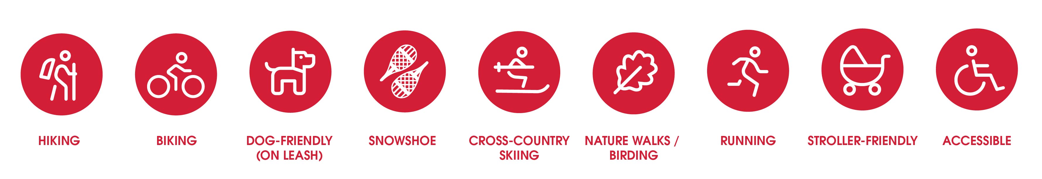
Core Trail Use Legend:
Bobcaygeon & Area

Bobcaygeon Wilderness Park
Bobcaygeon Wilderness Park provides over eight acres of safe, accessible trails for walking, hiking, cross-country skiing and snowshoeing through a beautiful mature forest. The park also provides a unique educational opportunity to visitors.
A large pollinator patch showcases hundreds of native plants and highlights the importance of pollinators, especially bees to our ecosystems.
Interpretive signs provide another educational component, explaining the significance of many of the natural features found within the park and along the trails.
The Bobcaygeon Wilderness Park is located in the northeast corner of Bobcaygeon, just off County Road 36.

Dunsford Nature Trail
The Dunsford Nature Trail is a recently built trail on a converted railway line. It extends 2.5 km from Dunsford to Verulam Concession Road 2. The trail passes through an area of lowland swamp and forest at the headwaters of a branch of Emily Creek.
Access to this trail is available in the village of Dunsford, which is located northeast of Lindsay and southwest of Bobcaygeon on Sturgeon Road (Kawartha Lakes Road 7).

John Eakins Walkway
This walkway is located along the Trent-Severn Waterway at Bobcaygeon Lock 32, a National Historic Site of Canada.
The walkway is dedicated to former politician John Eakins. Access to the trail is available in the Town of Bobcaygeon at Lock 32.

Gamiing Nature Centre Trails
Explore the wetlands and forests at Gamiing Nature Centre. The 55 hectare property includes over 7 km of trails and 15 hectares of wetland along scenic Pigeon Lake. Future plans include a 600 metre boardwalk into the marsh.
Address: 1884 Pigeon Lake Road, Lindsay, ON
For more information call 705-799-7083.

Kawartha Settlers’ Village Trail
Kawartha Settlers' Village features a beautiful nature trail that extends around the perimeter of their 9 acre property, so as you stroll along you will catch glimpses of log homes and historic buildings – and perhaps a sketcher or two – adding to the tranquil atmosphere.
The trail is completely natural with mature trees, historic flowers and vines. The grass is kept short and the trail provides a peaceful walk. Plan a walk and visit the Village while you are there.
Address: 85 Dunn St, Bobcaygeon, ON
For more information call 705-738-6163
Coboconk & Area

Balsam Lake Provincial Park
Balsam Lake Provincial Park has two hiking trails.
Lookout Trail - a 2.6 km walk through eskers and kames formed over 10,000 years ago from the Wisconsin Glacier. Enjoy a panoramic view of the surrounding area.
Plantation Trail - a 4.2 km moderate forest trek with both natural and pioneer highlightss
Kinmount & Area

Somerville Tract
Somerville Tract is comprised of 3,420 hectares of mixed forest property. There are three trail loops covering a variety of terrain including pine plantations, wetlands, hardwoods and rock outcrops.
Somerville Tract offers many kilometers of double track. The rolling cottage roads and forest tracks are ideal for mountain bikes.
Location: 5.6 km west of Kinmount on Arterial Road 45.
For further information: 705-324-9411 extension 1176

Lindsay & Area


The Rivera Park Trail
The Rivera Park Trail is located on the east side of the Scugog River in Lindsay. The trail is 2 km and takes approximately 30 minutes to walk.
The trail is open year-round and is great for a variety of outdoor activities.
For more information: 705-324-9411 extension 1301.

The Scugog River Trail
The Scugog River Trail follows the Scugog River on the east side of Lindsay. This abandoned rail line was paved by the Rotary Club of Lindsay and is accessible for walkers, wheelchairs, strollers and roller skates.
This trail is non-motorized.
You can access the trail from Logie Street and King Street.

Carew Park - McDonald Park
This 4 km trail is well lit and located in downtown Lindsay.
For more information: 705-324-9411 extension 1301

Lindsay Legacy Trail
The Lindsay Legacy Trail is 1.6 km section of paved trail from Victoria Junction (the corner of William Street North and Orchard Park Road, Lindsay) to Thunder Bridge Road, along the Victoria Rail Trail Corridor.
This trail is great for any form of active transportation. Stop by the railway station replica for information on geocaching, train history and local wildlife.
Omemee & Area


Emily Tract
Emily Tract is located on Arterial Road 14, just west of Cowan's Bay and Emily Provincial Park.
Emily Tract comprises 99.2 hectares (205 acres) of mixed forest property, with two trail loops winding through the property allowing you to explore unique glacial land features including moraines and eskers.
Emily Tract contains two trail loops: Loop 1 is gently rolling and heavily forested and Loop 2 crosses a wooden bridge, is hillier and is also heavily forested.
For more information: 705-324-9411 extension 1176

Pontypool & Area


Trail Use Guidelines:

Try to stay on the trail, even if it's rough and muddy.

Stay to the centre of the trail. Walking or cycling on the edge of the trail can widen the trail, causing damage and erosion.

Travel single file to avoid widening the trail.

Avoid sensitive vegetation and watch where you put your feet.

Be especially cautious around horses and bikers, stay to the right of the trail and let them pass.

If you are in a group and are not following a marked trail (i.e., walking through an open field) try to spread out rather than following in each other's footsteps to reduce environmental impact.

Allow for future use of the outdoors, by leaving it better than you found it. Carry out what you carry in, don't burn or bury trash.

Respect the environment and other trail users. Be considerate and honour other's desire for solitude and a peaceful outdoor experience.
