Coboconk Paddling Routes
Home of Canada’s fresh water summit, Coboconk sits on the highest elevation of navigable water in Canada and the third highest in the world. From this point, you can navigate all oceans, giving paddlers an interesting opportunity to think globally while acting locally.
As an island in the Gull River, this village features two watercraft launches with enough parking to make it easy for a group of paddlers to enjoy a day on the water together.
Enjoy calm, scenic stretches ideal for a leisurely canoe or kayak, or set out on longer journeys that link to neighbouring lakes and waterways. With easy access, beautiful shorelines, and plenty of spots to stop and explore, Coboconk offers some of the most rewarding paddling routes in Kawartha Lakes.

Gull River - Coboconk to Indian Point PP
Easy | 3-4 hours | 8 km round-trip | No Portages

The story of this route from The Land Canadian Adventures:
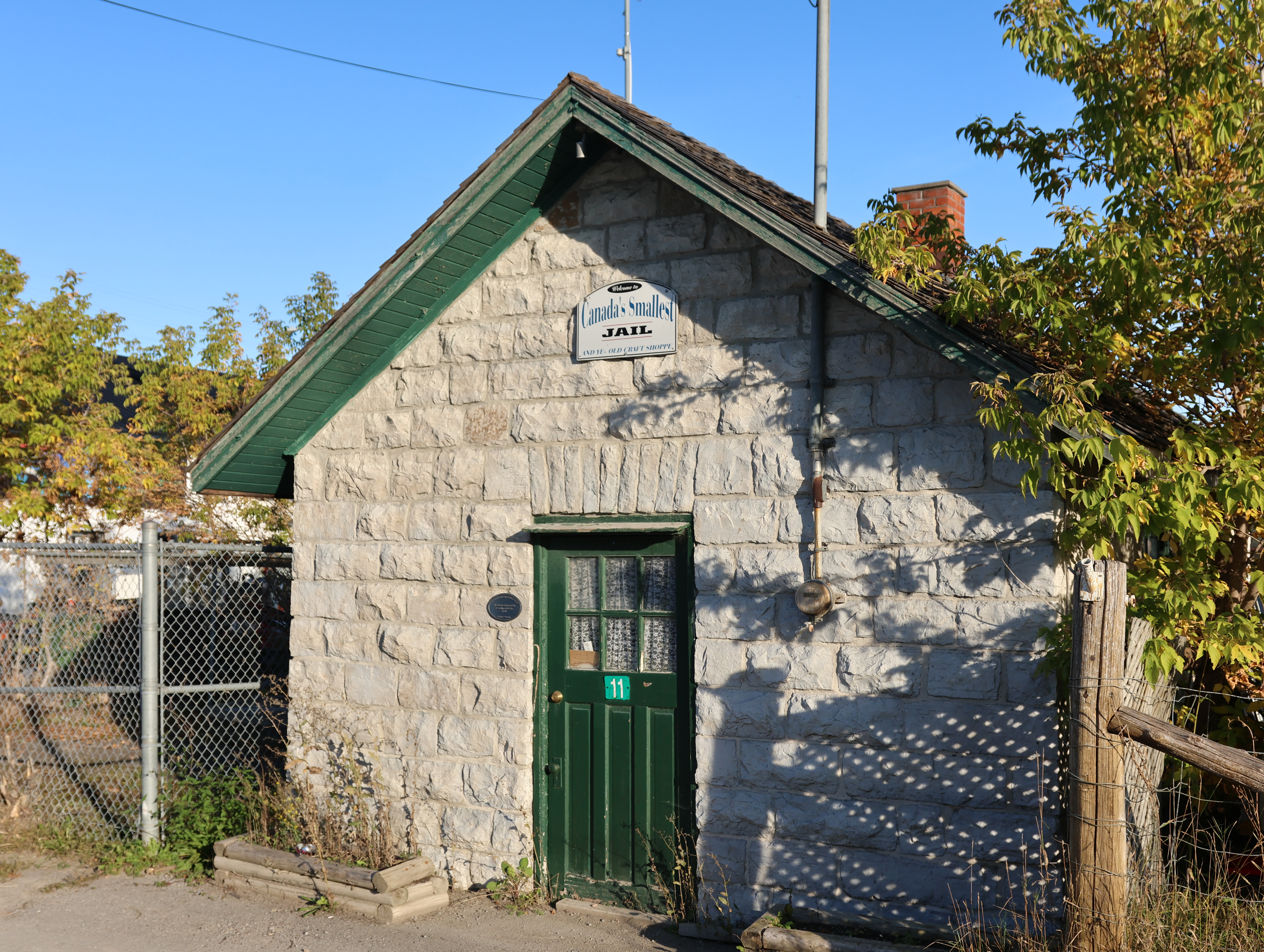
Not only is Coboconk home to the world’s smallest jail – now a local makers’ market – but much more interestingly, it is Canada’s “freshwater summit” since the town sits on the highest body of freshwater in the country from which you can navigate all oceans. It always gives this group of paddlers an interesting opportunity to think globally while acting locally.
Mapping the paddling route that leads from Coboconk, down the Gull River, through nearby Balsam Lake and onwards through the Trent-Severn Waterway and around the world could keep a paddler busy for an afternoon or ten, but enjoying the paddling opportunities that this town offers doesn’t require nearly that amount of ambition. Coboconk is basically an island in the Gull River, and includes at least two lovely places to put in, with enough parking to make it easy for your group to find a place.
If you’re looking to stay nearby, Parks Canada has oTENTiks and small cabins available to book at the Rosedale lock, about 10km south of Coboconk.

Paint & Paddle: The Group of Seven Connection
Distance: 5 km
There’s some fascinating Canadian heritage to this stretch of the Gull River as well. This was a favourite plein air painting and paddling locale for J.E.H. MacDonald, one of the founding members of the Group of Seven painters who helped create a uniquely Canadian aesthetic with their oil on canvas inspired by the ruggedness of the natural landscapes of The Land Between and Algoma regions. Every year, J.E.H. MacDonald planned a canoeing and fishing trip to Coboconk with his son, and produced some of his lesser known work while his son fished along the banks. His 1918 pastoral “Gull River” was stolen in a high-profile art heist earlier this decade and has never resurfaced, but you can find the subject of the painting heading south from the town of Coboconk!
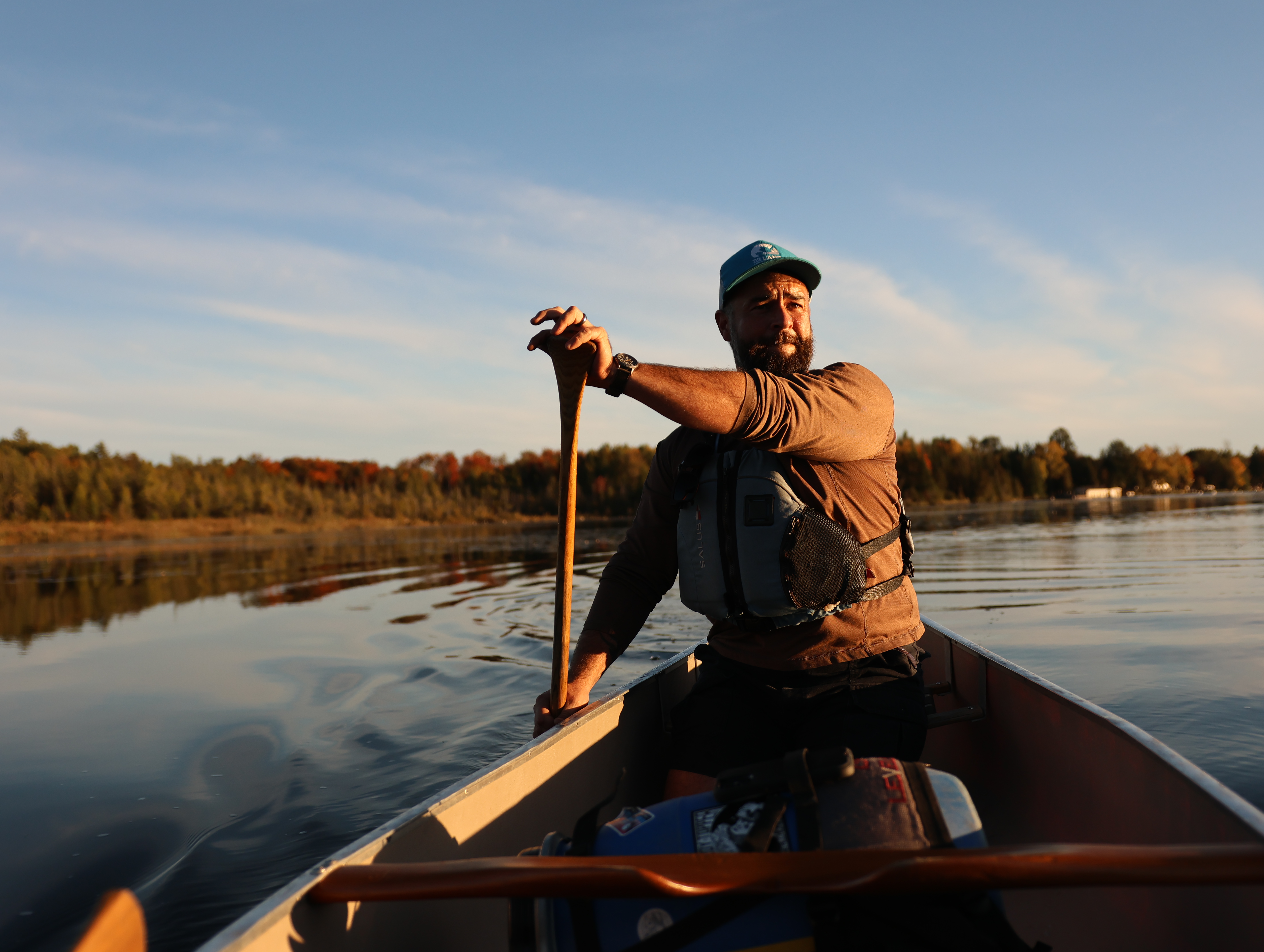
When I first heard of Coby’s Group of Seven connection, I snuck away with my canoe for an exploratory paddle. Looking for a good place for plein air painting excursions, I launched from the Coboconk Community Centre on the northeast side of Highway 35, and paddled north under the bridge towards Silver Lake.
This was a very different aspect of the Gull River than I’d paddled before at the rip-roaring rapids of the white water preserve farther upstream. Its waters are placid and inspiring, even just a short paddle from the townsite, and I found myself in expansive thought on the nature of artistic experience, and the wider spiritual benefits of painting and paddling.
The sunset paddle to Silver Lake was lovely, and in the absence of any wind or boat traffic I managed the 5 kilometer return trip in just over an hour. Nevertheless, I hadn’t found what I was looking for: a place along the route to pull over and imaginatively connect to the Canadian art history this place helped bring to life.

The Route South
Distance: 8 km
This time, we dropped in at the Public Access Boat Launch at the foot of Victoria Street: there’s nice parking space there, a dock there decorated with two red Parks Canada “Kawartha Chairs” and a nice space for getting the little ones ready. A young family was chilling by the shoreline on our most recent voyage We launched our boats there for a lovely afternoon exploring the completely undeveloped eastern shore of Indian Point Provincial Park, one of two non-operating parks we explored for this project. The peninsula extends from the townsite deep into the heart of Balsam Lake, creating the characteristic twin wingtip appearance of the northern end of the lake.
Consisting of low-lying limestone shelf, the lakeshore property of Indian Point Provincial Park contains alvar topography. Alvars are a globally-rare ecosystem characterized by very thin or no soil over a mantle of limestone bedrock, and they support a host of increasingly rare species, including many endangered birds, such as the loggerhead shrike. Ontario is home to over half of the world’s remaining alvars, including the famous Carden Alvar Formation, of which Indian Point is a part.
From the water, the shoreline forms an increasingly dense wetland hosting bittern and heron as well as migratory songbirds. At the land, a shallow escarpment pops up out of the water hemmed with cedar and white spruce, thinning to upland red oak and maple punctuated by towering white pine, to remind you that this is the unique “Land Between” the St. Lawrence Lowlands and the Canadian Shield.
I always plan a mid-way stop at the 4 km mark, near an old boy scout camp for a shoreline snack of coffee and pastries from Nanna’s Diner and basked in the late-summer sun. While laying out after refreshments, we imagined J.E.H. MacDonald and his young one picking their way along the same shoreline, hunting for the perfect little fishing hole and placement for his painting easel. When the little ones finally maxed out their bandwidth for the excursion, we called it a day and returned to the pull out. Thankfully, Rosie’s Dockside Bar and Grill restaurant is within walking distance of the boat launch on the west bank and has a riverside patio that calls out for cold drinks and cups of Kawartha Dairy ice cream.
Balsam Lake Provincial Park
Moderate | 5/10/14 km | Day trip | No Portages

The story of this route from The Land Canadian Adventures:
Balsam Lake Provincial Park is ten square kilometers of protected woodland and shoreline on the northwestern shores of its namesake lake. It has the distinction of being located on the highest body of freshwater in Canada from which sea-worthy craft can reach all the major oceans and circumnavigate the globe. As well as being a natural stopping place for boaters on the Trent-Severn Waterway, Balsam Lake Provincial Park is well known for its sandy beaches, day-trip hiking trails, summer canoe rentals, and for hosting its very own farmer’s market. Renowned for its fishery, Balsam Lake is good for pickerel and muskie as well as small and largemouth bass.
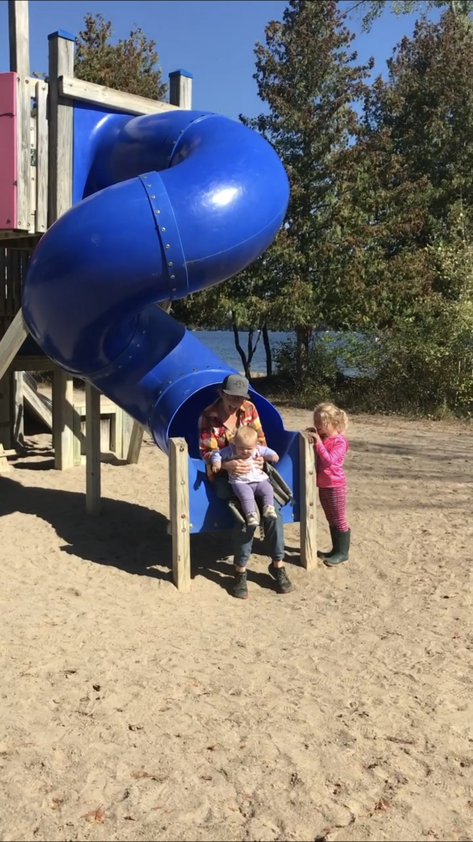
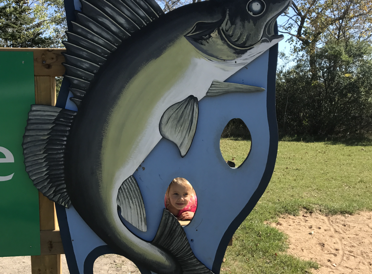
After checking in at the park office (where we got some much needed hot coffee), we proceeded to park in one of their several beach-side lots, and an easy 50m carry transported all our paddling gear to the beautiful sandy beaches for which Balsam Lake is known. Of course, we had to stop to let the kids explore the massive walleye sign with creative cut outs for your family’s smiling faces, and pay a visit to their waterfront playground, with swings, bridges and climbing structures.
Most folks launch their own paddlecraft from the sandy beach and tour the immediate vicinity of the park’s waterfront. For a longer excursion, you can cross the northwest arm of the lake and pick a fishing spot near the tip of Indian Point peninsula. For island explorers, Grand Island sits in the centre of the lake and a small offshore island on Grand’s southwest coast presents another clear objective.

Balsam Lake Provincial Park Aerial View
That Magical Spot
For canoe, kayak and standup paddle board rentals, look no further than Buckeye Surf & Snow Shop the local outdoor store and outfitters on the Main Street waterfront. They have canoe, kayak and standup paddle board rentals. You can park your bike or vehicle and hop right into your rental craft from their riverside boardwalk and explore the waterway northeast towards Pigeon Lake from there. Of course, Buckeye staff can help you choose the right craft based on your experience and ability, and outfit you with the appropriate PFD, paddle and safety gear for your day trip.

The Beach & The Food
After our paddle, we crashed on the beach, splashed in the shallows, scrambled on the glacial erratic boulders dotting the shoreline and chilled out in hammocks strung between the trees lining the edge of the woods and the sand. The kids kept rotating between these stations, while I slipped out to boil some water for hot drinks and set out a spread of snacks on one of the picnic tables. Fresh fruit, Empire Cheese and crackers went perfectly with a collection of butter tarts from the Kirkfield Restaurant and the award-winning Quaker Oaks Farm. It all really hit the spot, washed down, of course, with hot coffee.